
Limmat topographic map
Interactive map
Click on the map to display elevation.
About this map
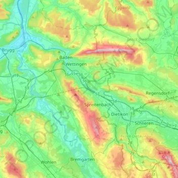
Name: Limmat topographic map, elevation, terrain.
Location: Limmat, A1;A3, Würenlos, Bezirk Baden, Aargau, 8956, Schweiz (47.36662 8.23557 47.50585 8.54403)
Average elevation: 477 m
Minimum elevation: 326 m
Maximum elevation: 853 m