
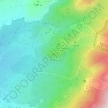
Las Cabezas topographic map
Interactive map
Click on the map to display elevation.
About this map
Name: Las Cabezas topographic map, elevation, terrain.
Average elevation: 1,316 m
Minimum elevation: 1,135 m
Maximum elevation: 1,751 m
Other topographic maps
Click on a map to view its topography, its elevation and its terrain.
Puerto de Cotos
España > Castilla y León > Real Sitio de San Ildefonso
Puerto de Cotos, Real Sitio de San Ildefonso, Segovia, Castilla y León, 40100, España
Average elevation: 1,864 m
Puerto de Navacerrada
España > Castilla y León > Real Sitio de San Ildefonso > Puerto de Navacerrada
Puerto de Navacerrada, Real Sitio de San Ildefonso, Segovia, Castilla y León, 40100, España
Average elevation: 1,823 m
Valsaín
España > Castilla y León > Real Sitio de San Ildefonso
Valsaín, Real Sitio de San Ildefonso, Segovia, Castilla y León, 40109, España
Average elevation: 1,256 m