
Cauderès topographic map
Interactive map
Click on the map to display elevation.
About this map
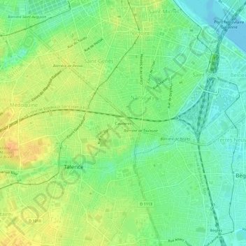
Name: Cauderès topographic map, elevation, terrain.
Average elevation: 16 m
Minimum elevation: -2 m
Maximum elevation: 34 m
Other topographic maps
Click on a map to view its topography, its elevation and its terrain.
Parc André Curvale
France > Nouvelle-Aquitaine > Gironde > Talence
Parc André Curvale, Talence, Bordeaux, Gironde, Nouvelle-Aquitaine, France métropolitaine, 33400, France
Average elevation: 20 m
Talence
France > Nouvelle-Aquitaine > Gironde > Talence
Talence, Bordeaux, Gironde, Nouvelle-Aquitaine, France métropolitaine, 33400, France
Average elevation: 19 m