
Thank you for supporting this site ❤️
Make a donation
Make a donation
Praia do Vau topographic map
Click on the map to display elevation.
Thank you for supporting this site ❤️
Make a donation
Make a donation
About this map
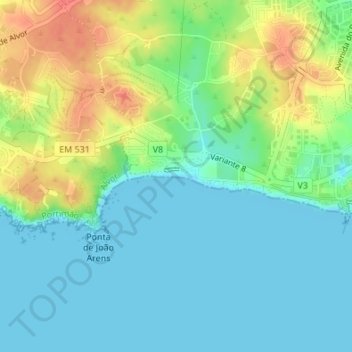
Name: Praia do Vau topographic map, elevation, terrain.
Location: Praia do Vau, Portimão, Faro, Portugal (37.11922 -8.56122 37.12031 -8.55735)
Average elevation: 17 m
Minimum elevation: 0 m
Maximum elevation: 49 m
Thank you for supporting this site ❤️
Make a donation
Make a donation
Other topographic maps
Click on a map to view its topography, its elevation and its terrain.