
罗布泊镇 topographic map
Interactive map
Click on the map to display elevation.
About this map
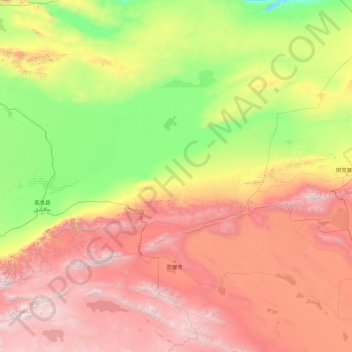
Name: 罗布泊镇 topographic map, elevation, terrain.
Location: 罗布泊镇, Qakilik, 巴音郭楞蒙古自治州, Xinjiang, China (37.78371 86.68536 41.37673 93.81947)
Average elevation: 2,076 m
Minimum elevation: 549 m
Maximum elevation: 5,994 m