
Whitefish Dunes State Park topographic map
Interactive map
Click on the map to display elevation.
About this map
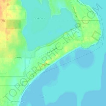
Name: Whitefish Dunes State Park topographic map, elevation, terrain.
Average elevation: 181 m
Minimum elevation: 172 m
Maximum elevation: 207 m
Other topographic maps
Click on a map to view its topography, its elevation and its terrain.
Potawatomi State Park
United States > Wisconsin > Door County > Sturgeon Bay
Potawatomi State Park, North Duluth Avenue, Sturgeon Bay, Town of Nasewaupee, Door County, Wisconsin, 54235, United States
Average elevation: 195 m