
Thank you for supporting this site ❤️
Make a donation
Make a donation
Hesperange topographic map
Click on the map to display elevation.
Thank you for supporting this site ❤️
Make a donation
Make a donation
About this map
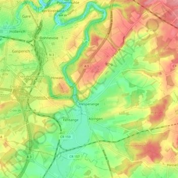
Name: Hesperange topographic map, elevation, terrain.
Location: Hesperange, Canton Luxembourg, Luxembourg (49.54809 6.11371 49.60828 6.20989)
Average elevation: 294 m
Minimum elevation: 246 m
Maximum elevation: 345 m
Thank you for supporting this site ❤️
Make a donation
Make a donation