
Bloomfield topographic map
Interactive map
Click on the map to display elevation.
About this map
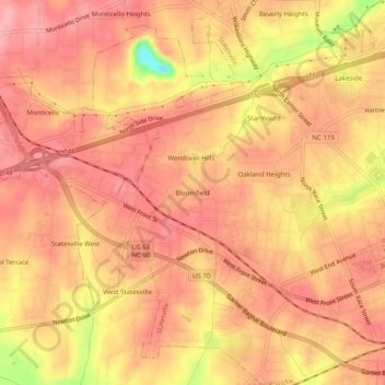
Name: Bloomfield topographic map, elevation, terrain.
Average elevation: 279 m
Minimum elevation: 197 m
Maximum elevation: 307 m
Other topographic maps
Click on a map to view its topography, its elevation and its terrain.
Shannon Acres
United States > North Carolina > Iredell County > Statesville
Shannon Acres, Statesville, Iredell County, North Carolina, United States
Average elevation: 254 m
Statesville
United States > North Carolina > Iredell County > Statesville > Statesville
Statesville, Iredell County, North Carolina, 28687, United States
Average elevation: 266 m