
Thank you for supporting this site ❤️
Make a donation
Make a donation
Tampico topographic map
Click on the map to display elevation.
Thank you for supporting this site ❤️
Make a donation
Make a donation
About this map
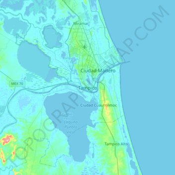
Name: Tampico topographic map, elevation, terrain.
Location: Tampico, Tamaulipas, 89080, Mexico (22.05576 -98.01777 22.37576 -97.69777)
Average elevation: 7 m
Minimum elevation: -4 m
Maximum elevation: 143 m
Thank you for supporting this site ❤️
Make a donation
Make a donation