
Thank you for supporting this site ❤️
Make a donation
Make a donation
Pitapali topographic map
Click on the map to display elevation.
Thank you for supporting this site ❤️
Make a donation
Make a donation
About this map
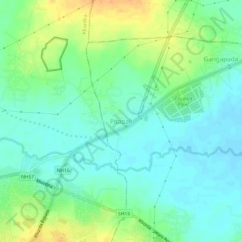
Name: Pitapali topographic map, elevation, terrain.
Location: Pitapali, Jatani, Khordha, Odisha, 752057, India (20.17705 85.63589 20.21705 85.67589)
Average elevation: 38 m
Minimum elevation: 26 m
Maximum elevation: 60 m
Thank you for supporting this site ❤️
Make a donation
Make a donation
Other topographic maps
Click on a map to view its topography, its elevation and its terrain.