
兴隆镇 topographic map
Interactive map
Click on the map to display elevation.
About this map
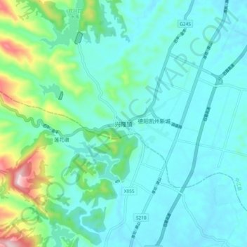
Name: 兴隆镇 topographic map, elevation, terrain.
Location: 兴隆镇, 德阳市, 中江县, Sichuan, China (30.83043 104.54737 30.91043 104.62737)
Average elevation: 520 m
Minimum elevation: 449 m
Maximum elevation: 845 m