
Bañalbufar topographic map
Interactive map
Click on the map to display elevation.
About this map
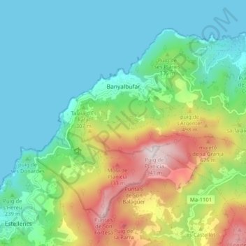
Name: Bañalbufar topographic map, elevation, terrain.
Location: Bañalbufar, Sierra de Tramontana, Islas Baleares, 07191, España (39.65484 2.48725 39.70180 2.56618)
Average elevation: 270 m
Minimum elevation: -1 m
Maximum elevation: 928 m