
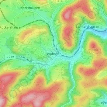
Feudingen topographic map
Interactive map
Click on the map to display elevation.
About this map
Name: Feudingen topographic map, elevation, terrain.
Average elevation: 470 m
Minimum elevation: 367 m
Maximum elevation: 612 m
Other topographic maps
Click on a map to view its topography, its elevation and its terrain.
Feudingerhütte
Deutschland > Nordrhein-Westfalen > Kreis Siegen-Wittgenstein > Bad Laasphe > Feudingen
Feudingerhütte, Feudingen, Bad Laasphe, Kreis Siegen-Wittgenstein, Nordrhein-Westfalen, 57334, Deutschland
Average elevation: 465 m