
Lake Carnegie topographic map
Interactive map
Click on the map to display elevation.
Lake Carnegie
The lake is approximately 100 kilometres (62 mi) in length and approximately 30 kilometres (19 mi) at its widest part. It has a total area of approximately 5,714 square kilometres (2,206 sq mi), making it one of the largest lakes in Australia. The surface elevation is 439 m (1,440 ft) above mean sea-level.
About this map
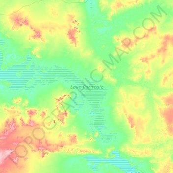
Name: Lake Carnegie topographic map, elevation, terrain.
Average elevation: 466 m
Minimum elevation: 435 m
Maximum elevation: 566 m