
Obira topographic map
Interactive map
Click on the map to display elevation.
About this map
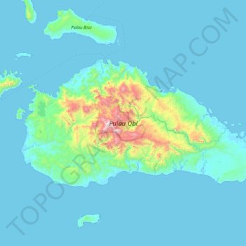
Name: Obira topographic map, elevation, terrain.
Location: Obira, Halmahera Selatan, North Maluku, Indonesia (-1.73786 127.39181 -1.33071 128.16820)
Average elevation: 118 m
Minimum elevation: 0 m
Maximum elevation: 1,537 m
Other topographic maps
Click on a map to view its topography, its elevation and its terrain.
Busua
Indonesia > North Maluku > Halmahera Selatan
Busua, Halmahera Selatan, North Maluku, Indonesia
Average elevation: 49 m