
Thank you for supporting this site ❤️
Make a donation
Make a donation
Puits topographic map
Click on the map to display elevation.
Thank you for supporting this site ❤️
Make a donation
Make a donation
Puits
La commune s'étend sur 20,8 km2 à une altitude comprise entre 275 et 353 mètres.
Thank you for supporting this site ❤️
Make a donation
Make a donation
About this map
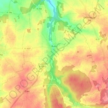
Name: Puits topographic map, elevation, terrain.
Average elevation: 324 m
Minimum elevation: 271 m
Maximum elevation: 361 m
Thank you for supporting this site ❤️
Make a donation
Make a donation