
Masherbrum topographic map
Click on the map to display elevation.
Masherbrum
Masherbrum (Urdu: مشہ بروم ; formerly known as K1) is a mountain located in the Ghanche District in the Gilgit Baltistan region of Pakistan. With an elevation of 7,821 metres (25,659 feet), it ranks as the 22nd highest mountain globally and the 9th highest in Pakistan. It holds the distinction of being the first mapped peak in the Karakoram mountain range during the Great Trigonometrical Survey, leading to its K-number designation as "K1".
About this map
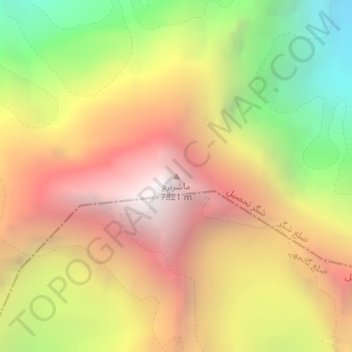
Name: Masherbrum topographic map, elevation, terrain.
Average elevation: 6,469 m
Minimum elevation: 4,912 m
Maximum elevation: 7,798 m
Other topographic maps
Click on a map to view its topography, its elevation and its terrain.
Biafo Glacier
Pakistan > Gilgit-Baltistan > Shigar District
Biafo Glacier converging at Hispar La with 49 kilometres (30 mi) long Hispar Glacier situated at an elevation of 5,128 metres (16,824 ft), forms the glacial system considered as the world's longest non-polar glacial system which spans an overall distance of around 120 kilometres (75 mi). This frozen pathway…
Average elevation: 4,618 m