
Thank you for supporting this site ❤️
Make a donation
Make a donation
Germantown topographic map
Click on the map to display elevation.
Thank you for supporting this site ❤️
Make a donation
Make a donation
About this map
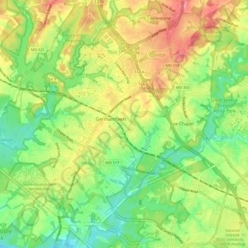
Name: Germantown topographic map, elevation, terrain.
Location: Germantown, Montgomery County, Maryland, United States (39.12779 -77.31718 39.21479 -77.21150)
Average elevation: 130 m
Minimum elevation: 73 m
Maximum elevation: 207 m
Thank you for supporting this site ❤️
Make a donation
Make a donation