
Thank you for supporting this site ❤️
Make a donation
Make a donation
Elizabethtown topographic map
Click on the map to display elevation.
Thank you for supporting this site ❤️
Make a donation
Make a donation
About this map
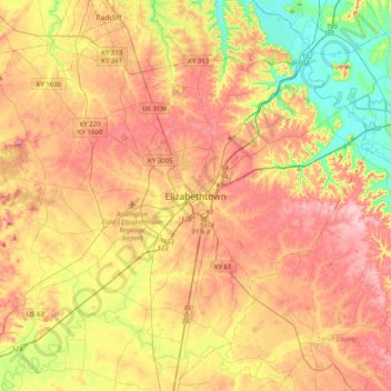
Name: Elizabethtown topographic map, elevation, terrain.
Location: Elizabethtown, Hardin County, Kentucky, 42701, United States (37.53395 -86.01913 37.85395 -85.69913)
Average elevation: 221 m
Minimum elevation: 128 m
Maximum elevation: 306 m
Thank you for supporting this site ❤️
Make a donation
Make a donation