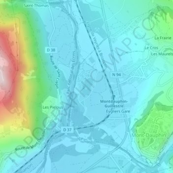
Plan d'Eau d'Eygliers topographic map
Interactive map
Click on the map to display elevation.
About this map
Name: Plan d'Eau d'Eygliers topographic map, elevation, terrain.
Average elevation: 969 m
Minimum elevation: 876 m
Maximum elevation: 1,418 m

Click on the map to display elevation.
Name: Plan d'Eau d'Eygliers topographic map, elevation, terrain.
Average elevation: 969 m
Minimum elevation: 876 m
Maximum elevation: 1,418 m