
兴海县 topographic map
Interactive map
Click on the map to display elevation.
About this map
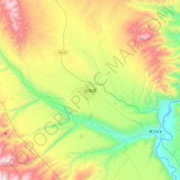
Name: 兴海县 topographic map, elevation, terrain.
Location: 兴海县, 海南藏族自治州, 青海省, 中国 (35.42677 99.82840 35.74677 100.14840)
Average elevation: 3,393 m
Minimum elevation: 2,658 m
Maximum elevation: 4,556 m
Other topographic maps
Click on a map to view its topography, its elevation and its terrain.