
Hyde Park topographic map
Interactive map
Click on the map to display elevation.
About this map
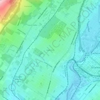
Name: Hyde Park topographic map, elevation, terrain.
Average elevation: 262 m
Minimum elevation: 202 m
Maximum elevation: 526 m
Other topographic maps
Click on a map to view its topography, its elevation and its terrain.
Scranton
United States > Pennsylvania > Lackawanna County > Scranton
Scranton, Lackawanna County, Pennsylvania, 18503, United States
Average elevation: 407 m
Keyser Valley
United States > Pennsylvania > Lackawanna County > Scranton
Keyser Valley, Scranton, Lackawanna County, Pennsylvania, 18504, United States
Average elevation: 328 m