
Thank you for supporting this site ❤️
Make a donation
Make a donation
Cherokee Village topographic map
Click on the map to display elevation.
Thank you for supporting this site ❤️
Make a donation
Make a donation
About this map
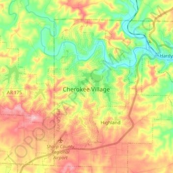
Name: Cherokee Village topographic map, elevation, terrain.
Location: Cherokee Village, Sharp County, Arkansas, United States (36.25729 -91.63767 36.33726 -91.50959)
Average elevation: 177 m
Minimum elevation: 106 m
Maximum elevation: 256 m
Thank you for supporting this site ❤️
Make a donation
Make a donation
Other topographic maps
Click on a map to view its topography, its elevation and its terrain.