
Hall County topographic map
Interactive map
Click on the map to display elevation.
About this map
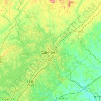
Name: Hall County topographic map, elevation, terrain.
Location: Hall County, Georgia, United States (34.09828 -84.06284 34.51410 -83.61525)
Average elevation: 339 m
Minimum elevation: 208 m
Maximum elevation: 773 m
Other topographic maps
Click on a map to view its topography, its elevation and its terrain.
Worley Crossroads
United States > Georgia > Cherokee County > Worley Crossroads
Average elevation: 378 m