
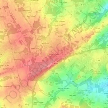
Le Petit Palais topographic map
Interactive map
Click on the map to display elevation.
About this map
Name: Le Petit Palais topographic map, elevation, terrain.
Average elevation: 64 m
Minimum elevation: 8 m
Maximum elevation: 100 m
Other topographic maps
Click on a map to view its topography, its elevation and its terrain.
Le Moulin de Plouer
France > Bretagne > Côtes-d'Armor > Plouër-sur-Rance
Le Moulin de Plouer, Plouër-sur-Rance, Dinan, Côtes-d'Armor, Bretagne, France métropolitaine, 22490, France
Average elevation: 30 m
La Galerie
France > Bretagne > Côtes-d'Armor > Plouër-sur-Rance
La Galerie, Plouër-sur-Rance, Dinan, Côtes-d'Armor, Bretagne, France métropolitaine, 22490, France
Average elevation: 32 m
La Basse Minotais
France > Bretagne > Côtes-d'Armor > Plouër-sur-Rance > La Basse Minotais
La Basse Minotais, Plouër-sur-Rance, Dinan, Côtes-d'Armor, Bretagne, France métropolitaine, 22490, France
Average elevation: 34 m
Les Vaux Grapins
France > Bretagne > Côtes-d'Armor > Plouër-sur-Rance
Les Vaux Grapins, Plouër-sur-Rance, Dinan, Côtes-d'Armor, Bretagne, France métropolitaine, 22490, France
Average elevation: 40 m