
Barrage de Chaumeçon topographic map
Interactive map
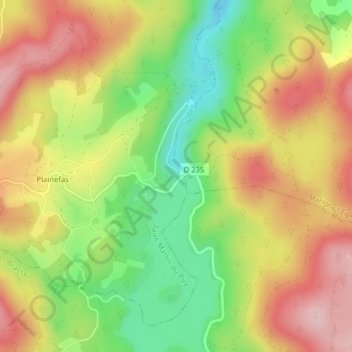
Click on the map to display elevation.
About this map
Name: Barrage de Chaumeçon topographic map, elevation, terrain.
Average elevation: 450 m
Minimum elevation: 343 m
Maximum elevation: 552 m
Other topographic maps
Click on a map to view its topography, its elevation and its terrain.
Plainefas
France > Bourgogne-Franche-Comté > Nièvre > Saint-Martin-du-Puy
Plainefas, Saint-Martin-du-Puy, Château-Chinon (Ville), Nièvre, Bourgogne-Franche-Comté, France métropolitaine, 58140, France
Average elevation: 470 m