
San Gerardo topographic map
Interactive map
Click on the map to display elevation.
About this map
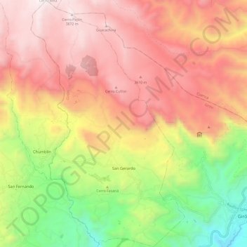
Name: San Gerardo topographic map, elevation, terrain.
Location: San Gerardo, Girón, Azuay, Ecuador (-3.17570 -79.24766 -3.05862 -79.17434)
Average elevation: 3,029 m
Minimum elevation: 1,955 m
Maximum elevation: 3,906 m
Other topographic maps
Click on a map to view its topography, its elevation and its terrain.