
Thank you for supporting this site ❤️
Make a donation
Make a donation
Wüllen topographic map
Click on the map to display elevation.
Thank you for supporting this site ❤️
Make a donation
Make a donation
About this map
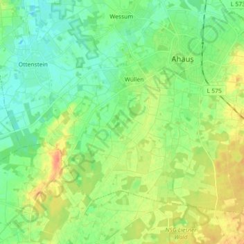
Name: Wüllen topographic map, elevation, terrain.
Location: Wüllen, Ahaus, Kreis Borken, Nordrhein-Westfalen, Deutschland (52.02106 6.90207 52.08624 7.04358)
Average elevation: 56 m
Minimum elevation: 41 m
Maximum elevation: 79 m
Thank you for supporting this site ❤️
Make a donation
Make a donation
Other topographic maps
Click on a map to view its topography, its elevation and its terrain.