
Thank you for supporting this site ❤️
Make a donation
Make a donation
Fargo topographic map
Click on the map to display elevation.
Thank you for supporting this site ❤️
Make a donation
Make a donation
About this map
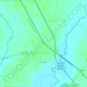
Name: Fargo topographic map, elevation, terrain.
Location: Fargo, Clinch County, Georgia, United States (30.67294 -82.58907 30.70378 -82.55697)
Average elevation: 34 m
Minimum elevation: 30 m
Maximum elevation: 38 m
Thank you for supporting this site ❤️
Make a donation
Make a donation
Other topographic maps
Click on a map to view its topography, its elevation and its terrain.