
Pic d’Eyne topographic map
Interactive map
Click on the map to display elevation.
About this map
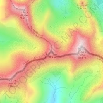
Name: Pic d’Eyne topographic map, elevation, terrain.
Average elevation: 2,541 m
Minimum elevation: 2,179 m
Maximum elevation: 2,855 m
Other topographic maps
Click on a map to view its topography, its elevation and its terrain.
Prats-Balaguer
France > Occitanie > Pyrénées-Orientales > Fontpédrouse
Prats-Balaguer, Fontpédrouse, Prades, Pyrénées-Orientales, Occitanie, France métropolitaine, 66360, France
Average elevation: 1,490 m
La Font
France > Occitanie > Pyrénées-Orientales > Fontpédrouse > Prats-Balaguer
La Font, La Fount, Prats-Balaguer, Fontpédrouse, Prades, Pyrénées-Orientales, Occitanie, France métropolitaine, 66360, France
Average elevation: 1,414 m