
Thank you for supporting this site ❤️
Make a donation
Make a donation
Raborive topographic map
Click on the map to display elevation.
Thank you for supporting this site ❤️
Make a donation
Make a donation
About this map
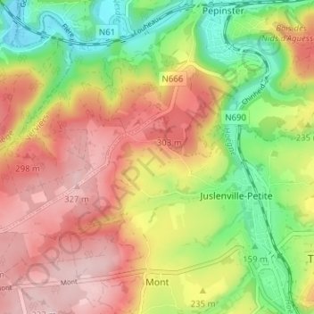
Name: Raborive topographic map, elevation, terrain.
Location: Raborive, Theux, Verviers, Liège, Wallonie, 4910, Belgique (50.52883 5.77046 50.56883 5.81046)
Average elevation: 228 m
Minimum elevation: 115 m
Maximum elevation: 334 m
Thank you for supporting this site ❤️
Make a donation
Make a donation
Other topographic maps
Click on a map to view its topography, its elevation and its terrain.
Thank you for supporting this site ❤️
Make a donation
Make a donation