
Бурятия topographic map
Interactive map
Click on the map to display elevation.
About this map
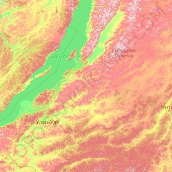
Name: Бурятия topographic map, elevation, terrain.
Location: Бурятия, Дальневосточный федеральный округ, Россия (50.15824 106.93214 55.27824 112.05214)
Average elevation: 965 m
Minimum elevation: 422 m
Maximum elevation: 2,546 m