
Llobera topographic map
Interactive map
Click on the map to display elevation.
About this map
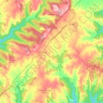
Name: Llobera topographic map, elevation, terrain.
Location: Llobera, Solsonés, Lérida, Cataluña, España (41.88711 1.40808 41.96122 1.50469)
Average elevation: 797 m
Minimum elevation: 655 m
Maximum elevation: 912 m