
Plougastel topographic map
Interactive map
Click on the map to display elevation.
About this map
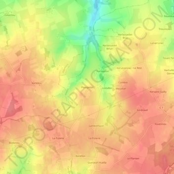
Name: Plougastel topographic map, elevation, terrain.
Average elevation: 110 m
Minimum elevation: 64 m
Maximum elevation: 131 m
Other topographic maps
Click on a map to view its topography, its elevation and its terrain.
Croix Neuve
France > Bretagne > Finistère > Guiclan
Croix Neuve, Guiclan, Morlaix, Finistère, Bretagne, France métropolitaine, 29410, France
Average elevation: 66 m
Keradennec
France > Bretagne > Finistère > Guiclan > Keradennec
Keradennec, Guiclan, Morlaix, Finistère, Bretagne, France métropolitaine, 29410, France
Average elevation: 88 m