
Thank you for supporting this site ❤️
Make a donation
Make a donation
Gouviães topographic map
Click on the map to display elevation.
Thank you for supporting this site ❤️
Make a donation
Make a donation
About this map
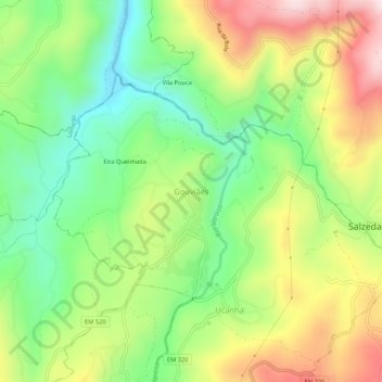
Name: Gouviães topographic map, elevation, terrain.
Location: Gouviães, Tarouca, Viseu, 5110-460, Portugal (41.03819 -7.76975 41.07819 -7.72975)
Average elevation: 515 m
Minimum elevation: 313 m
Maximum elevation: 791 m
Thank you for supporting this site ❤️
Make a donation
Make a donation
Other topographic maps
Click on a map to view its topography, its elevation and its terrain.