
Make a donation
Tinduf topographic map
Click on the map to display elevation.
Make a donation
About this map
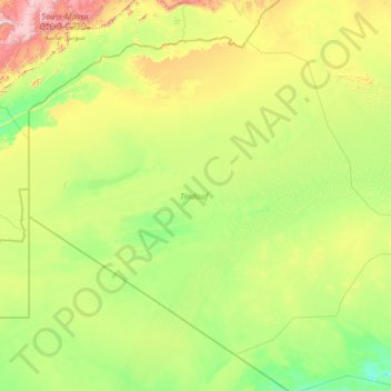
Name: Tinduf topographic map, elevation, terrain.
Location: Tinduf, Algeria (25.51348 -8.66891 29.60791 -2.98025)
Average elevation: 467 m
Minimum elevation: 209 m
Maximum elevation: 2,201 m
Make a donation
Other topographic maps
Click on a map to view its topography, its elevation and its terrain.
Algiers
Algeria > Algiers > Sidi M'Hamed District > Alger-Centre
Algiers was a walled city from the time of the deys until the close of the 19th century. The French, after their occupation of the city (1830), built a rampart, parapet and ditch, with two terminal forts, Bab Azoun باب عزون to the south and Bab-el-Oued اد to the north. The forts and part of the…
Average elevation: 45 m
Beni Brahim
Algeria > Setif > Beni Ouartilane District > Ain Lagradj > Beni Brahim
Average elevation: 1,020 m