
Thank you for supporting this site ❤️
Make a donation
Make a donation
Segadães topographic map
Click on the map to display elevation.
Thank you for supporting this site ❤️
Make a donation
Make a donation
About this map
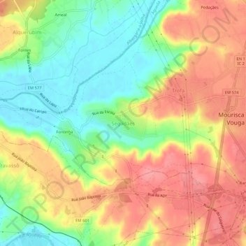
Name: Segadães topographic map, elevation, terrain.
Location: Segadães, Águeda, Aveiro, 3750-591, Portugal (40.58635 -8.50846 40.62635 -8.46846)
Average elevation: 48 m
Minimum elevation: 3 m
Maximum elevation: 90 m
Thank you for supporting this site ❤️
Make a donation
Make a donation
Other topographic maps
Click on a map to view its topography, its elevation and its terrain.
Thank you for supporting this site ❤️
Make a donation
Make a donation
Thank you for supporting this site ❤️
Make a donation
Make a donation