Masvingo Province topographic map
Interactive map
Click on the map to display elevation.
About this map
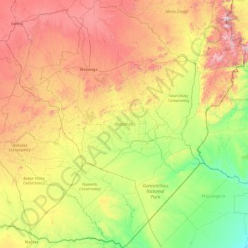
Name: Masvingo Province topographic map, elevation, terrain.
Location: Masvingo Province, Zimbabwe (-22.42411 29.73450 -19.15076 32.40560)
Average elevation: 700 m
Minimum elevation: 82 m
Maximum elevation: 2,267 m
Other topographic maps
Click on a map to view its topography, its elevation and its terrain.
Harare
Harare (/həˈrɑːreɪ/ hə-RAR-ay), formerly known as Salisbury (/ˈsɔːlzbəri/ SAWLZ-bər-ee), is the capital and largest city of Zimbabwe, and is the most populous city in the country. The city proper has an area of 982.3km2 (378.7 mi2), a population of 1,849,600 as of the 2022 census and an estimated…
Average elevation: 1,461 m
Bulawayo Province
Bulawayo experiences water shortages in drought seasons due to the overwhelming increase in population versus the static and sometimes decreasing capacity of the reserve dams. The geographical factors causing water scarcity are rising temperatures, the area's high elevation and the arid environment of…
Average elevation: 1,321 m