
Lungòni/Santa Teresa Gallura topographic map
Interactive map
Click on the map to display elevation.
About this map
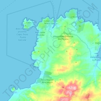
Name: Lungòni/Santa Teresa Gallura topographic map, elevation, terrain.
Location: Lungòni/Santa Teresa Gallura, SS, Sardenha, 07028, Itália (41.14880 9.13810 41.25908 9.31453)
Average elevation: 52 m
Minimum elevation: -1 m
Maximum elevation: 354 m