
Wotenick topographic map
Interactive map
Click on the map to display elevation.
About this map
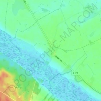
Name: Wotenick topographic map, elevation, terrain.
Average elevation: 11 m
Minimum elevation: -3 m
Maximum elevation: 40 m
Other topographic maps
Click on a map to view its topography, its elevation and its terrain.
Deven
Deutschland > Mecklenburg-Vorpommern > Mecklenburgische Seenplatte > Demmin
Deven, Demmin, Mecklenburgische Seenplatte, Mecklenburg-Vorpommern, 17109, Deutschland
Average elevation: 17 m