
Thank you for supporting this site ❤️
Make a donation
Make a donation
Carreiras topographic map
Click on the map to display elevation.
Thank you for supporting this site ❤️
Make a donation
Make a donation
About this map
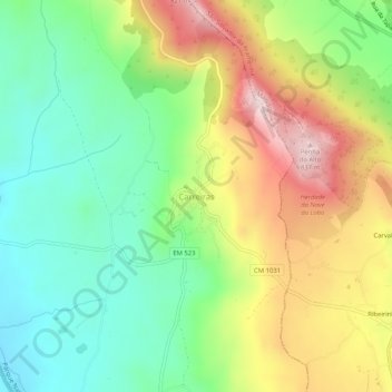
Name: Carreiras topographic map, elevation, terrain.
Location: Carreiras, Portalegre, 7300-355, Portugal (39.35200 -7.45223 39.39200 -7.41223)
Average elevation: 574 m
Minimum elevation: 403 m
Maximum elevation: 828 m
Thank you for supporting this site ❤️
Make a donation
Make a donation
Other topographic maps
Click on a map to view its topography, its elevation and its terrain.