
F'Kirina topographic map
Interactive map
Click on the map to display elevation.
About this map
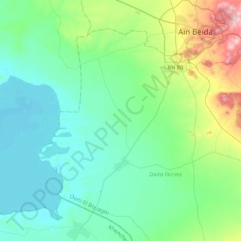
Name: F'Kirina topographic map, elevation, terrain.
Location: F'Kirina, Daïra F'Kirina, Oum El Bouaghi, Algérie (35.61517 7.19624 35.79829 7.49182)
Average elevation: 893 m
Minimum elevation: 829 m
Maximum elevation: 1,146 m