
Pen ar C'hoat topographic map
Interactive map
Click on the map to display elevation.
About this map
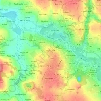
Name: Pen ar C'hoat topographic map, elevation, terrain.
Average elevation: 58 m
Minimum elevation: 16 m
Maximum elevation: 102 m
Other topographic maps
Click on a map to view its topography, its elevation and its terrain.
Lac de Poulinoc
France > Bretagne > Finistère > Saint-Renan > Poulinoc
Lac de Poulinoc, Poulinoc, Saint-Renan, Brest, Finistère, Bretagne, France métropolitaine, 29290, France
Average elevation: 50 m
Bel Air
France > Bretagne > Finistère > Saint-Renan
Bel Air, Saint-Renan, Brest, Finistère, Bretagne, France métropolitaine, 29290, France
Average elevation: 57 m
Toul an Aon
France > Bretagne > Finistère > Saint-Renan
Toul an Aon, Saint-Renan, Brest, Finistère, Bretagne, France métropolitaine, 29290, France
Average elevation: 61 m