
Riesweiler topographic map
Interactive map
Click on the map to display elevation.
About this map
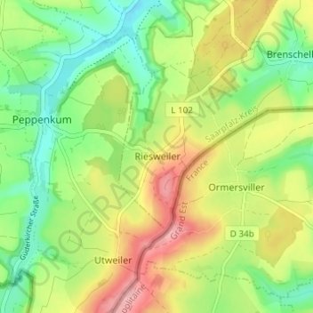
Name: Riesweiler topographic map, elevation, terrain.
Location: Riesweiler, Blieskastel, Saarpfalz-Kreis, Saarland, Deutschland (49.11908 7.28826 49.15908 7.32826)
Average elevation: 306 m
Minimum elevation: 251 m
Maximum elevation: 380 m