
刀告乡 topographic map
Interactive map
Click on the map to display elevation.
About this map
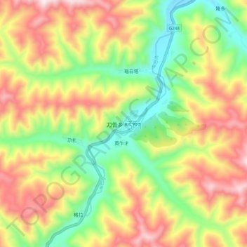
Name: 刀告乡 topographic map, elevation, terrain.
Location: 刀告乡, 卓尼县, 甘南藏族自治州, 甘肃省, 中国 (34.46188 103.08353 34.54188 103.16353)
Average elevation: 3,164 m
Minimum elevation: 2,804 m
Maximum elevation: 3,585 m
Other topographic maps
Click on a map to view its topography, its elevation and its terrain.