
Tsarevo topographic map
Interactive map
Click on the map to display elevation.
About this map
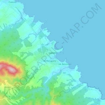
Name: Tsarevo topographic map, elevation, terrain.
Location: Tsarevo, Burgas, 8260, Bulgaria (42.13028 27.80829 42.21028 27.88829)
Average elevation: 38 m
Minimum elevation: -1 m
Maximum elevation: 321 m