
锷嘉镇 topographic map
Interactive map
Click on the map to display elevation.
About this map
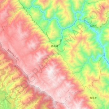
Name: 锷嘉镇 topographic map, elevation, terrain.
Location: 锷嘉镇, 双柏县, 楚雄彝族自治州, 云南省, 中国 (24.29562 101.06475 24.56800 101.39645)
Average elevation: 1,800 m
Minimum elevation: 631 m
Maximum elevation: 2,963 m
Other topographic maps
Click on a map to view its topography, its elevation and its terrain.