
Thank you for supporting this site ❤️
Make a donation
Make a donation
Barbelote topographic map
Click on the map to display elevation.
Thank you for supporting this site ❤️
Make a donation
Make a donation
About this map
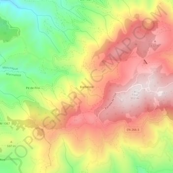
Name: Barbelote topographic map, elevation, terrain.
Location: Barbelote, Monchique, Faro, 8550-218, Portugal (37.29666 -8.63040 37.33666 -8.59040)
Average elevation: 594 m
Minimum elevation: 226 m
Maximum elevation: 894 m
Thank you for supporting this site ❤️
Make a donation
Make a donation
Other topographic maps
Click on a map to view its topography, its elevation and its terrain.