
Glindow topographic map
Interactive map
Click on the map to display elevation.
About this map
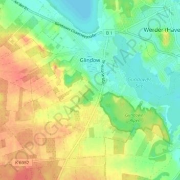
Name: Glindow topographic map, elevation, terrain.
Average elevation: 49 m
Minimum elevation: 27 m
Maximum elevation: 74 m
Bliesendorf mit Resau | Derwitz | Glindow mit Elisabethhöhe | Kemnitz mit Kolonie Zern | Petzow mit Löcknitz und Riegelberg | Phöben | Plötzin mit Neu Plötzin und Plessow | Töplitz mit Alt Töplitz, Eichholz, Göttin, Leest und Neu Töplitz
Other topographic maps
Click on a map to view its topography, its elevation and its terrain.
Phöben
Deutschland > Brandenburg > Potsdam-Mittelmark > Werder (Havel)
Phöben, Werder (Havel), Potsdam-Mittelmark, Brandenburg, 14542, Deutschland
Average elevation: 35 m
Petzow
Deutschland > Brandenburg > Potsdam-Mittelmark > Werder (Havel) > Petzow
Petzow, Werder (Havel), Potsdam-Mittelmark, Brandenburg, Deutschland
Average elevation: 36 m