
Thank you for supporting this site ❤️
Make a donation
Make a donation
Oudsbergen topographic map
Click on the map to display elevation.
Thank you for supporting this site ❤️
Make a donation
Make a donation
About this map
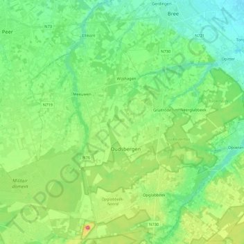
Name: Oudsbergen topographic map, elevation, terrain.
Location: Oudsbergen, Maaseik, Limburg, Flanders, Belgium (51.01877 5.45438 51.14635 5.66607)
Average elevation: 69 m
Minimum elevation: 34 m
Maximum elevation: 155 m
Thank you for supporting this site ❤️
Make a donation
Make a donation
Other topographic maps
Click on a map to view its topography, its elevation and its terrain.